Natural history of Maasai Stoves & Solar Project locations
Our Project began in the three of the villages of Monduli Juu, or upper Monduli. The town of Monduli lies at the foot of the Monduli Mountains to the west of Mount Meru and we located our headquarters and factory here. The Monduli Juu villages are up on the plateau behind this mountain, about fifteen minutes away by car.
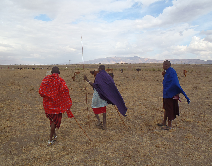
Maasai herding livestock
This location is very beautiful with wonderful sweeping views. One can see mountains in the distance including Ol Doinyo Lengai, the live volcano in the Rift Valley and the mountain home of Engai, the Maasai diety.
With all its beauty, access to water, the uncertainty of rain, and being off the electrical grid make this area a challenging place for people to live.
As we have added villages to the project lying south and west of the Monduli mountains and along the road from Arusha to the Rift Valley and the famous wildlife national parks of Tanzania, we established a second project hub in Mto wa Mbu.
Mto wa Mbu is in the Rift Valley at the base of the Ngorongoro Highlands escarpment. The salt lakes are along this branch of the valley. One of them lies right next to Mto wa Mbu where the entrance to the Lake Manyara National Park is located.
The Rift Valley is one of our planet’s most amazing geological features. A joint in the earth’s crust, it runs from Syria to Mozambique with the Jordan Valley and the Dead Sea along its path. It crosses the Red Sea, shapes the highlands of Eritrea and Ethiopia, and goes through Kenya and Tanzania on its way south.
Deforestation in the Maasai regions
Using a traditional three-stone interior cooking fire requires a lot of wood. As a result the local bush is rapidly shrinking. Women typically spend up to 12 hours each week gathering wood, and combined with long-term drought conditions, woodlands are under tremendous pressure. Our Project addresses these issues
- A single village, Eluwai, for example, loses 1.5-2 acres of firewood forest per year
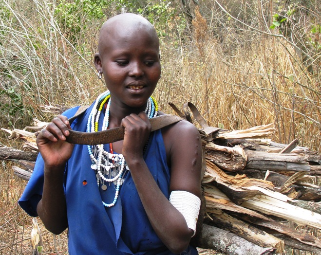 Where will the women in the Maasai bomas find firewood? In Eluwai village where the wood-gathering sites are closest, the women showed us how almost half of their forest resources have gone since 2007, losing up to two acres of wooded area per year.
In Losirwa, the wood is nearly gone, and forty percent of homes are now using cow dung. We are happy to discover that although our stove was designed to use firewood as fuel, it also works well with dung.
Drought and weather patterns in Maasai regions
The Maasai are worried that the rains are less predictable than they used to be. Typical weather patterns include periods of dryness with the autumn “short rains” and “long rains” during the spring. The short rains were late this year, causing concern about planting and cattle grazing seasons.
While we should be cautious about assuming global warming is responsible for any particular event or noticeable trend, there are concerns that climate change could have a strong impact on equatorial regions, including the Maasai lands of northern Tanzania and southern Kenya.
